Using big data to deliver better parks and public spaces
As part of our Planning Smarter Cities series Sabina Uffer, Head of Research for Cities, and Nerissa Moray, Associate Principal for Cities, explain how big data offers a dynamic approach to improving life in the urban jungle

Big data is a bit of a buzzword at the moment, but what exactly does it mean? For once, the name is not misleading, because big data does indeed refer to extremely large sets of data collected from a wide range of sources. This vast quantity of information is then analysed to reveal patterns, trends and associations relating to human behaviour and interaction.
Urban planners, policy-makers, designers and engineers are increasingly looking toward big data to enhance life for city dwellers. From tracking vehicles to create more efficient traffic movement, to mapping trees and installing sensors to determine their impact on air quality, big data can be applied to make informed decisions that improve the way our cities work.
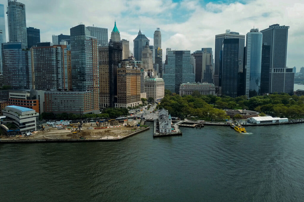
This blog focuses on an aspect of urban life that is fundamental to people’s wellbeing, yet receives very little attention in the debate around smart cities – parks and public spaces. These places provide vital green spaces for recreation and social interaction in an otherwise grey landscape, while also increasing the economic value of an area and improving the overall city ‘brand’. Given this, it makes sense to see how big data can be used to maximise these clear social, economic and environmental benefits.
Understanding a place: new ways of data collection, visualization, and analysis
Traditionally, managers of parks and public spaces have relied on observational methods to understand how people use their amenities – such a counting visitors and conducting surveys. Nowadays, new technologies can provide managers with faster, cheaper and more plentiful data sources.
Internet giants such as Google, Facebook and Twitter collect myriads of data from people using their smartphones at home, in the car, or out and about in public spaces. GPS allows these companies to connect this data to specific locations, and therefore map people’s experience in great detail.
For example, someone who visits Times Square and posts a picture on Facebook automatically provides data. Of course, not everyone visiting Times Square will have a smartphone, and not everyone with a smartphone will post on Facebook, but the wide use of such social network applications is still useful to detect visitor patterns. The only downside is that the data held by these private companies is not always readily accessible.
Other emerging technologies, such as sensors and video recognition, can also be used by park managers to better understand the way their spaces are being used. Already, video cameras and sensors can distinguish between pedestrians, cyclist and vehicles. They are now being developed so that they are able to not only identify different users, but also how a space is being used – for example, whether people are standing and chatting to one another, or just passing through.
These technologies offer 24/7 monitoring capabilities that create a wealth of data far exceeding that generated by manual visitor counts and surveys. In doing so, they are able to provide planners and park managers with the specific information they need to better design, operate and maintain public spaces.
Taking action: using data to drive design and operational improvements
From the earliest stages of design, big data analysis can help diagnose a space’s needs and shape development plans. It was applied in the creation of the 34th Street public plaza, where sensors were installed to track peak traffic volumes, times and areas. The resulting data helped determine the size and form of the public plaza and, now the new space is established, the same technology is being used to build an understanding of how people interact with it.
Visitor data can also be used to improve the way we use our parks and open spaces. Underuse of public space can create perceived or very real safety issues, leading to a downward spiral of neglect. Data analysis allows managers to identify underused areas and implement measures to revitalise them – ranging from simple solutions such as improving lighting, to more ambitious schemes to increase engagement with these areas. New York City is currently undertaking a pilot programme in which varied types of lighting are being installed in public spaces around 40 housing developments, enabling data to be collected that shows the impact of different lighting schemes on public safety.
Overuse, in contrast, detracts from the visitor experience and can cause excessive wear and tear on physical assets. To solve this issue, the stewards of D.C.’s Washington Monument introduced a free visitor ticketing system to handle both advance and in person bookings. This greatly improved people’s experience by reducing queuing times, prevented the grounds from being trampled at peak times, and allowed the stewards to gather rich visitor data. They were then able to use this data to adjust ticketing times to create more equitable access for various groups, such as schoolchildren, tour groups and individual visitors.
Big data can also be applied for the practical maintenance of our public spaces. Tracking peak visitor times and locations allows for the effective scheduling of activities such as rubbish collection or work on the grounds. Sophisticated technologies can even provide critical data to help with such tasks – sensor-equipped rubbish bins can be remotely monitored to determine when they near capacity, while other specialist devices can measure and report rain level, water quality, and other natural resource conditions to park managers in real time.
The bottom line: measuring success
As well as providing park and public area managers with the information they need to better understand and improve the use of their space, big data can help them assess their own efforts. So-called ‘sentiment analysis’ uses the same data-mining techniques described above to identify how people feel when they are in a specific space.
Blogs, Facebook posts and Tweets are searched for emotional expressions such as ‘happy’, ‘sad’ or ‘angry’, posted in relation to a particular place. While this type of data analysis should be used with a healthy dose of caution – people visiting certain areas have all kinds of feelings for all sorts of reasons – it is certainly some indication of success when tens of thousands of Facebook users update their status to say “I am soooo happy” when they visit Brooklyn Bridge Park.
As with all applications of technology in our towns and cities, however, the use of big data faces one big challenge – potential promoters, whether city administrators or private companies, want evidence of an economic return on their investment. This is a subject that is of critical importance to the whole construct of smart cities, and one that we will explore further later in this series.

Related content

Canning Town Estates Regeneration

What’s next given the SEC Climate Rule freeze?

Buro Happold supports New York Mayor’s Office with release of ‘EJNYC Report’ on Climate, Environmental Justice

RCRC Operational Framework Project

Buro Happold supports Green Economy Action Plan with New York City EDC and Mayor’s Office